

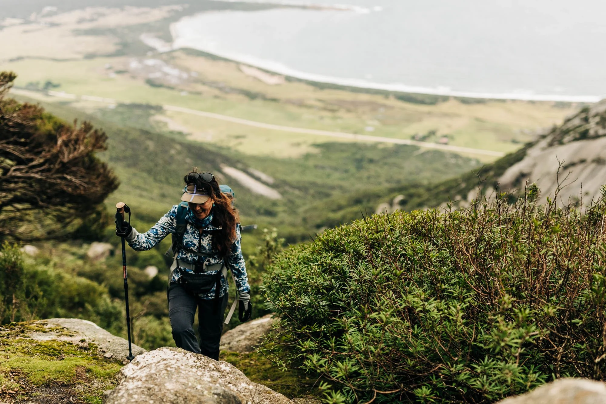
Flinders Island Walks
Whether you’re up for a short stroll or a summit challenge, Flinders Island walks offer some of the most spectacular scenery in Tasmania — without the crowds. From coastal tracks to granite peaks and forest trails, the island is a walker's paradise, shaped by nature and steeped in local stories.
With options ranging from family-friendly beach walks to half-day hikes and full-day climbs, walking is one of the best ways to connect with the land. Below are some of our favourite walks on Flinders Island to help you start planning your own island adventure.
-
Lady Barron Foreshore Walk
Distance: 1.5 km | Time: 30–45 minutes return | Grade: Easy
Perfect for a gentle stroll, the Lady Barron Foreshore Walk follows the coastline from the port to Yellow Beach. With views across Franklin Sound and plenty of birdlife along the way, this walk is great for spotting oystercatchers and taking in sea breezes. It’s also pram and kid-friendly — ideal for a relaxed afternoon out.
-
Strzelecki Peaks Walk
Distance: 5.5 km return | Time: 4–6 hours | Grade: Hard
For those up for a Flinders Island hike, this is the one. Climbing to the island’s highest point at 756 metres, the Strzelecki Peaks Walk is both challenging and rewarding. The trail ascends through the forest and up over granite ridges to a summit that reveals panoramic views of the entire island and beyond. Allow time for breaks and take plenty of water — Flinders Island hiking doesn't get much better than this.
-
Castle Rock Walk
Distance: 4.5 km return | Time: 1.5–2 hours | Grade: Moderate
This coastal walk near Marshall Bay takes you past windswept dunes and rugged shoreline to the iconic Castle Rock, a towering granite boulder perched above the sea. It’s one of the most popular Flinders Island walking tracks and a great option for photographers or walkers after a less strenuous, scenic route.
-
Trousers Point Walk
DescriptionDistance: 2 km return | Time: 1 hour | Grade: Easy–Moderate
Starting at the Trousers Point picnic area, this walk loops along the coast beneath Strzelecki National Park. It’s a great self-guided walk on Flinders Island, offering dramatic headlands, hidden coves and turquoise waters — plus, some of the island’s best beach views. Keep an eye out for wallabies and seabirds along the way. goes here
-
Bluff Track Fitness Trail
Distance: 2.7 km loop | Time: 30–45 minutes | Grade: Easy
This local favourite near Whitemark is perfect for morning walks or light jogs. The Bluff Track includes interpretive signs, fitness stations and coastal views, making it a great option for those easing into hiking or just stretching their legs before breakfast.
-
Wombat Rock
Distance: Approx. 5 km return | Time: 2–3 hours | Grade: Moderate
Wombat Rock is one of the most iconic Flinders Island walking tracks, offering a unique self-guided hike through fascinating geology and sweeping views. Starting from the top car park on The Dock Road (off Palana Road), the trail takes you up the eastern peak of Mount Killiecrankie. Along the way, you'll pass giant, wind-sculpted boulders, including the namesake wombat-shaped rock and enjoy panoramic coastal vistas. For keen walkers, this Flinders Island hike can link to the Diamond Gully Track for a longer adventure.
-
The Dock to Killiecrankie
Distance: Approx. 7 km one way | Time: 3–4 hours one way | Grade: Moderate
A coastal gem among Flinders Island walks, this point-to-point track weaves through diverse terrain, from quiet forest to striking cliffs and white sandy beaches. Starting at The Dock and ending at the Killiecrankie Beach picnic area (or in reverse), this walk is peppered with hand-painted signs and detours like Stacky’s Bight. Ideal for a self-guided walk, it's best completed with a car shuffle for convenience. This Flinders Island walking tour stands out for its dramatic scenery and geological features.
-
Diamond Gully Track
Distance: Part of a larger circuit | Time: 4–5 hours return | Grade: Moderate
Expect windswept granite, coastal views and a mix of forest and beach walking. Starting from The Dock or Killiecrankie, this route climbs Mount Killiecrankie and winds around Stacky’s Bight. It's one of the more varied Flinders Island walking tours — perfect for those wanting a longer, more immersive day out on foot.
-
Mount Killiecrankie Loop
Distance: 7–10 km circuit | Time: 6–8 hours | Grade: Moderate–Hard
One of the most rewarding full-day Flinders Island hikes, this loop combines Wombat Rock, The Dock to Killiecrankie and the Diamond Gully Track. It's a challenging and varied trail, from scrambling over boulders to wandering along beaches. Views from Mount Killiecrankie's summit make the effort worthwhile. This Flinders Island walk is a true highlight for adventurous walkers seeking dramatic landscapes and coastal serenity.
-
Patriarch Inlet to Red Bluff
Distance: Approx. 6 km return | Time: 2–3 hours | Grade: Easy–Moderate
This coastal Flinders Island walk is not to be missed for nature lovers and birdwatchers. Starting at the end of Memana Road, the trail winds through wetlands and along a remote beach towards the striking Red Bluff headland. The area is known for its birdlife, including soldier crabs and waterbirds and the resting site of a pod of stranded pilot whales from the 1970s. A peaceful self-guided walk on Flinders Island, this is best enjoyed at low tide.
-
Yellow Beach Foreshore Walk
Distance: 1.5 km | Time: 1.5–2 hours return | Grade: Easy
One of the most accessible walks on Flinders Island, this gentle track starts just east of the Lady Barron boat ramp and follows the coastline to Yellow Beach. With views over Franklin Sound, this is a family-friendly self-guided walk. There are plenty of picnic facilities, toilets and even a BBQ shelter on the beach. A popular choice for visitors based in Lady Barron, it's an easy way to experience the charm of Flinders Island walking tracks.
There are more trails worth exploring, from the Walkers Lookout viewpoint to forest walks around Wingaroo and Pillingers Peak. For detailed routes, signage updates and local tips, check out Tasmania Parks and Wildlife Service and view the Island Map — there’s sure to be a Flinders Island walk to suit your style and pace.

More Flinders Island walking tracks
Most walks on Flinders Island are self-guided, with clear signage and well-maintained tracks. For those after deeper insights or looking to explore off-the-beaten-path areas, Flinders Island walking tours are available through local guides. These tours often include cultural storytelling, ecology insights or even a packed picnic.
Self-guided or guided?
Spring and autumn are ideal for walking, with cooler temperatures and fewer visitors. Summer offers beautiful beach walks, but be sure to bring sun protection and extra water. Winter is quieter, and the mist over the peaks adds a certain magic. Just check the weather and trail conditions before heading out.

Best times to walk
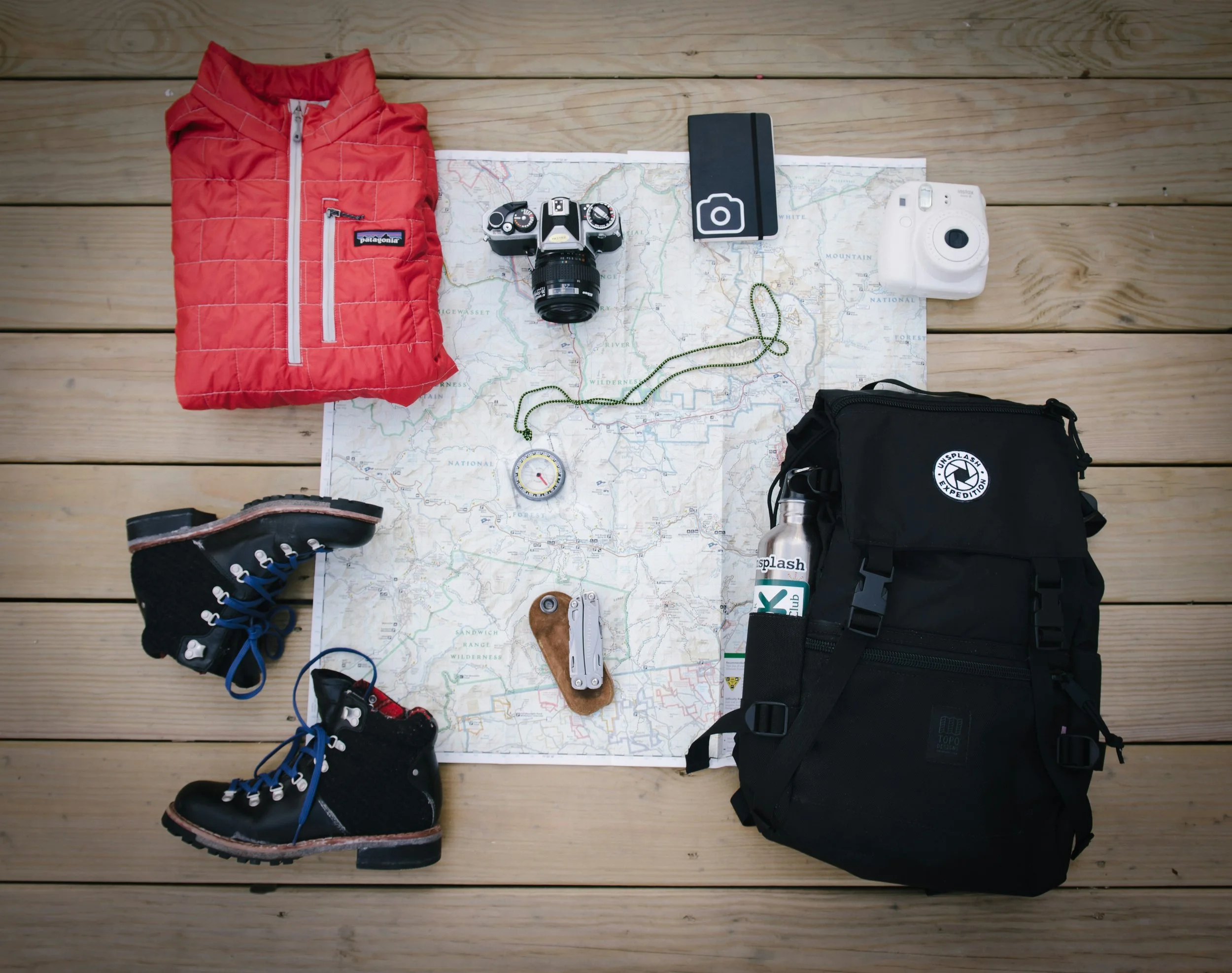
What to pack
Good walking shoes
Water and snacks
Sun protection (hat, sunscreen)
Weather-appropriate layers
A map or trail guide
Phone or camera
You’ll also find basic facilities like toilets and BBQ areas at major trailheads like Trousers Point and Lady Barron.
FAQs
-
No permits are needed for day walks, but park entry fees may apply.
-
Yes. Walks like Lady Barron Foreshore, Trousers Point and Bluff Track are perfect for families.
-
Good shoes, sun protection, layers, water and snacks. Mobile reception can be patchy in remote areas, so it’s smart to download a map before you go.
-
Yes, guided tours can be arranged for individuals or small groups that want cultural or nature insights to make the walk even more meaningful. Contact us for booking assistance.